Category:Adderstone with Lucker
Jump to navigation
Jump to search
English: Adderstone with Lucker is a civil parish in Northumberland, England. The parish includes the villages of Adderstone, Lucker, Warenford, Rosebrough, Newstead, Bellshill and Bradford, and has a population of 195.
civil parish in Northumberland, England  | |||||
| Upload media | |||||
| Instance of | |||||
|---|---|---|---|---|---|
| Named after | |||||
| Location | Northumberland, North East England, England | ||||
 | |||||
Subcategories
This category has the following 7 subcategories, out of 7 total.
A
B
- Bellshill, Northumberland (14 F)
- Bradford, Adderstone with Lucker (10 F)
H
- Hoppen Hall (7 F)
L
N
- Newstead, Northumberland (10 F)
W
Media in category "Adderstone with Lucker"
The following 200 files are in this category, out of 457 total.
(previous page) (next page)-
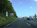
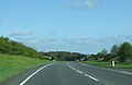
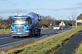 A busy A1 - geograph.org.uk - 3806683.jpg 1,600 × 1,053; 274 KB
-
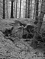 A Collapsed OB - geograph.org.uk - 4314194.jpg 3,415 × 4,463; 5.12 MB
-
 A line up of sheep near Lucker Moor - geograph.org.uk - 3482193.jpg 1,024 × 768; 282 KB
-
 A section of Commonflat Plantation clear felled - geograph.org.uk - 5618245.jpg 1,600 × 1,022; 354 KB
-
 A1 northbound - geograph.org.uk - 2947211.jpg 640 × 480; 52 KB
-
 A1 northbound - geograph.org.uk - 2947221.jpg 640 × 426; 45 KB
-
 A1 northbound - geograph.org.uk - 2947231.jpg 640 × 424; 34 KB
-
 A1 northbound - geograph.org.uk - 2947242.jpg 640 × 455; 39 KB
-
 A1 northbound - geograph.org.uk - 2947254.jpg 640 × 455; 48 KB
-
 A1 northbound - geograph.org.uk - 2947274.jpg 640 × 415; 54 KB
-
 A1 northbound - geograph.org.uk - 2947291.jpg 640 × 414; 50 KB
-
 A1 northbound - geograph.org.uk - 2947322.jpg 640 × 439; 51 KB
-
 A1 northbound - geograph.org.uk - 2947345.jpg 640 × 451; 53 KB
-
 A1 northbound - geograph.org.uk - 2947358.jpg 640 × 421; 57 KB
-
 A1 northbound - geograph.org.uk - 2947382.jpg 640 × 447; 61 KB
-
 A1 northbound - geograph.org.uk - 2947393.jpg 640 × 435; 46 KB
-
 A1 northbound - geograph.org.uk - 2947405.jpg 640 × 480; 60 KB
-
 A1 northbound - geograph.org.uk - 2952637.jpg 640 × 469; 41 KB
-
 A1 northbound - geograph.org.uk - 2952656.jpg 640 × 441; 39 KB
-
 A1 northbound - geograph.org.uk - 2952666.jpg 640 × 463; 57 KB
-
 A1 northbound - geograph.org.uk - 2952673.jpg 640 × 451; 44 KB
-
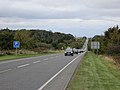
 A1 southbound near Purdy Lodge - geograph.org.uk - 4596497.jpg 640 × 480; 60 KB
-
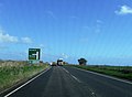
 A1 towards Berwick - geograph.org.uk - 4309551.jpg 640 × 417; 45 KB
-
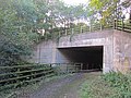 A1 underpass - geograph.org.uk - 3176875.jpg 640 × 480; 335 KB
-
 A1 without a windscreen - geograph.org.uk - 3190514.jpg 640 × 480; 256 KB
-
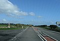
 A1, Adderstone View - geograph.org.uk - 4308223.jpg 640 × 462; 49 KB
-
 Access to the A1 - geograph.org.uk - 3816194.jpg 1,600 × 1,102; 280 KB
-
 Across the bridge - geograph.org.uk - 2141752.jpg 640 × 394; 143 KB
-
 Adderstone Mains - geograph.org.uk - 4351377.jpg 1,600 × 1,241; 359 KB
-
 Adderstone Mains - geograph.org.uk - 4354576.jpg 2,048 × 1,536; 1.07 MB
-
 Along the Waren Burn - geograph.org.uk - 4282448.jpg 800 × 600; 447 KB
-
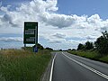
 Approaching the A1 - geograph.org.uk - 3806692.jpg 1,600 × 1,097; 403 KB
-
 Approaching the A1 - geograph.org.uk - 3806759.jpg 1,600 × 1,195; 289 KB
-
 Arable field boundary - geograph.org.uk - 4344563.jpg 2,048 × 1,536; 1.29 MB
-
 Arable field east of Birchwood Hall - geograph.org.uk - 4086337.jpg 2,048 × 1,536; 769 KB
-
 Arable field near Binsal Hill - geograph.org.uk - 4079671.jpg 2,048 × 1,536; 739 KB
-
 Arable field north west of Lucker - geograph.org.uk - 4354532.jpg 2,048 × 1,536; 843 KB
-
 Arable field north west of Lucker - geograph.org.uk - 4354551.jpg 2,048 × 1,536; 1.08 MB
-
 Arable field south of Newstead - geograph.org.uk - 4079672.jpg 2,048 × 1,536; 909 KB
-
 Arable fields near Lucker - geograph.org.uk - 3816197.jpg 1,600 × 1,300; 305 KB
-
 Arable Land Adjoining Whinny Plantation - geograph.org.uk - 4314236.jpg 4,592 × 3,448; 4.16 MB
-
 Arable land near Bamburgh - geograph.org.uk - 2556055.jpg 640 × 359; 216 KB
-
 Arable land near The Crag - geograph.org.uk - 3838282.jpg 1,024 × 768; 178 KB
-
 Arable land next to Law Plantation - geograph.org.uk - 3838295.jpg 1,024 × 768; 161 KB
-
 Arable land South East of Old Mousen - geograph.org.uk - 3837356.jpg 1,024 × 768; 189 KB
-
 Arable land, Newstead - geograph.org.uk - 4282417.jpg 800 × 600; 426 KB
-
 Autumn at Twizell Lake - geograph.org.uk - 2141784.jpg 640 × 425; 89 KB
-
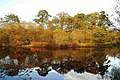 Autumn reflections - geograph.org.uk - 2141802.jpg 640 × 425; 113 KB
-
 B1341 crosses Waren Burn - geograph.org.uk - 2311934.jpg 640 × 430; 45 KB
-
 B1341 near Adderstone Hall - geograph.org.uk - 4596502.jpg 640 × 480; 68 KB
-
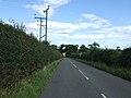
 B1341 near Lucker - geograph.org.uk - 461769.jpg 640 × 400; 68 KB
-
 B1341 towards Bamburgh - geograph.org.uk - 4601269.jpg 640 × 480; 67 KB
-
 B6348 towards Bellshill - geograph.org.uk - 4601259.jpg 640 × 480; 69 KB
-
 B6348 towards Bellshill - geograph.org.uk - 4601261.jpg 640 × 480; 85 KB
-
 Bale store, Twizell - geograph.org.uk - 3301682.jpg 640 × 480; 327 KB
-
 Bare hedge casts a shadow - geograph.org.uk - 5322317.jpg 2,560 × 1,920; 3.24 MB
-
 Barley field - geograph.org.uk - 5353570.jpg 1,024 × 683; 331 KB
-
 Barley, Adderstone Mains - geograph.org.uk - 5352490.jpg 1,024 × 683; 371 KB
-
 Barley, Bradford - geograph.org.uk - 4282452.jpg 800 × 600; 412 KB
-
 Bellshill Farm - geograph.org.uk - 4601262.jpg 640 × 480; 55 KB
-
 Big rock on Rosebrough Moor - geograph.org.uk - 1085625.jpg 640 × 480; 67 KB
-
 Birchwood Hall - geograph.org.uk - 3806762.jpg 1,600 × 1,200; 354 KB
-
 Bridge over the Waren Burn - geograph.org.uk - 3816205.jpg 1,600 × 1,200; 439 KB
-
 Bridge over the Waren Burn at Bradford - geograph.org.uk - 4344551.jpg 2,048 × 1,536; 1.4 MB
-
 Bridleway across grassland near Clatteringhouses - geograph.org.uk - 3488010.jpg 1,024 × 768; 301 KB
-
 Buildings at Adderstone Lowmill - geograph.org.uk - 4354562.jpg 2,048 × 1,536; 1.04 MB
-
 Buildings at Lucker Hall Farm - geograph.org.uk - 4353266.jpg 2,048 × 1,536; 1.06 MB
-
 Bushes on Hoppenwood Bank - geograph.org.uk - 2457804.jpg 640 × 430; 36 KB
-
 Cairn, Longstone Hill - geograph.org.uk - 3304487.jpg 640 × 480; 273 KB
-
 Cairn, Longstone Hill - geograph.org.uk - 3304489.jpg 640 × 480; 288 KB
-
 Cairns, Longstone Hill - geograph.org.uk - 3302938.jpg 640 × 480; 285 KB
-
 Cattle grazing on Huds Knowe at Birchwood Hall - geograph.org.uk - 4080773.jpg 2,048 × 1,152; 466 KB
-
 Cattle near Bradford - geograph.org.uk - 6236340.jpg 1,024 × 683; 479 KB
-
 Cattle near Bradford - geograph.org.uk - 6236727.jpg 1,024 × 683; 461 KB
-
 Cattle, Longstone Hill - geograph.org.uk - 3304493.jpg 640 × 480; 264 KB
-
 Cattle, Ratchwood - geograph.org.uk - 2577808.jpg 640 × 480; 239 KB
-
 Central cairn on Longstone Hill - geograph.org.uk - 3484251.jpg 1,024 × 768; 230 KB
-
 Churned mud - geograph.org.uk - 5322327.jpg 2,560 × 1,920; 3.43 MB
-
 Clatteringhouses - geograph.org.uk - 4559004.jpg 1,600 × 1,044; 278 KB
-
 Common Lizard at Twizell Mill - geograph.org.uk - 3352691.jpg 1,024 × 682; 153 KB
-
 Commonflat - geograph.org.uk - 5352824.jpg 1,024 × 683; 367 KB
-
 Commonflat - geograph.org.uk - 5352826.jpg 1,024 × 683; 331 KB
-
 Communications tower by the A1 - geograph.org.uk - 3577293.jpg 4,608 × 3,456; 5.71 MB
-
 Contradictory speed limits - geograph.org.uk - 5319101.jpg 2,560 × 1,920; 3.4 MB
-
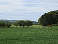
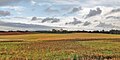
 Cornfield View - geograph.org.uk - 3098366.jpg 640 × 425; 99 KB
-
 Cottage beside road to Old Mousen - geograph.org.uk - 4351351.jpg 1,600 × 1,106; 320 KB
-
 Cottages at Birchwood Hall - geograph.org.uk - 4080764.jpg 2,048 × 1,536; 652 KB
-
 Cottages in Bradford - geograph.org.uk - 6236017.jpg 1,024 × 683; 491 KB
-
 Country east of railway - geograph.org.uk - 6306476.jpg 1,024 × 512; 152 KB
-
 Country north of Lucker - geograph.org.uk - 6306472.jpg 1,024 × 512; 150 KB
-
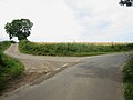 Country road junction to the south of Newstead - geograph.org.uk - 4079670.jpg 2,048 × 1,536; 627 KB
-
 Country road north east of Birchwood Hall - geograph.org.uk - 4080780.jpg 2,048 × 1,536; 700 KB
-
 Country road passing Long Bank Plantation - geograph.org.uk - 4080745.jpg 2,048 × 1,536; 844 KB
-
 Covered reservoir, Twizell - geograph.org.uk - 3190535.jpg 640 × 480; 327 KB
-
 Cricket ground and pavilion - geograph.org.uk - 3806678.jpg 1,600 × 1,173; 378 KB
-

-
 Crop field near Lucker - geograph.org.uk - 4596503.jpg 640 × 480; 108 KB
-
 Crop field north of the B6348 - geograph.org.uk - 4596488.jpg 640 × 480; 89 KB
-
 Crop field off the A1 - geograph.org.uk - 4601265.jpg 640 × 480; 66 KB
-
 Crossing railway line at Lucker - geograph.org.uk - 1394100.jpg 640 × 480; 86 KB
-
 Crossroads north west of Lucker - geograph.org.uk - 4354548.jpg 2,048 × 1,536; 1.17 MB
-
 Crushed Under The Weight - geograph.org.uk - 4314212.jpg 3,431 × 4,583; 4.79 MB
-
 Cultivator on the roadside south of Newstead - geograph.org.uk - 4080723.jpg 2,048 × 1,536; 819 KB
-
 Defunct limekiln - geograph.org.uk - 4354535.jpg 1,600 × 1,138; 345 KB
-
 Defunct quarry^ - geograph.org.uk - 4354512.jpg 1,600 × 1,181; 436 KB
-
 Derelict cottage at Clatteringhouses - geograph.org.uk - 3487550.jpg 1,024 × 768; 314 KB
-
 Derelict shed west of Adderstone Lowmill - geograph.org.uk - 4354569.jpg 2,048 × 1,536; 1.05 MB
-
 Derelict sheep pens at Clatteringhouses - geograph.org.uk - 3487554.jpg 1,024 × 768; 387 KB
-
 Derelict stone shed west of Adderstone Lowmill - geograph.org.uk - 4354570.jpg 2,048 × 1,536; 1,017 KB
-
 Derelict stone walled enclosure - geograph.org.uk - 4354531.jpg 1,600 × 1,244; 534 KB
-
 Descending Lidderton Hill - geograph.org.uk - 3602107.jpg 640 × 428; 94 KB
-
 Disused lime kiln - geograph.org.uk - 4351358.jpg 1,600 × 1,111; 324 KB
-
 Disused limekilns near Bellshill Quarry - geograph.org.uk - 4366722.jpg 2,048 × 1,536; 1.59 MB
-

-
 Dovecote, Lucker Hall (geograph 6874435).jpg 1,280 × 1,024; 1.37 MB
-
 Down-and-out tree on Rosebrough Moor - geograph.org.uk - 1085680.jpg 640 × 480; 71 KB
-
 Duck pond - geograph.org.uk - 4354537.jpg 1,600 × 1,200; 475 KB
-
 East Coast Main Line - geograph.org.uk - 4282434.jpg 800 × 600; 448 KB
-
 East Coast Main Line - geograph.org.uk - 4282437.jpg 800 × 600; 485 KB
-
-
 Edge of the moor, near Clatteringhouses - geograph.org.uk - 3487548.jpg 1,024 × 768; 195 KB
-
 Electricity poles - geograph.org.uk - 3806675.jpg 1,015 × 1,200; 190 KB
-
 Embleton's Bog - geograph.org.uk - 2311945.jpg 640 × 430; 48 KB
-
 Embleton's Bog - geograph.org.uk - 2457799.jpg 640 × 438; 42 KB
-
 Embleton's Bog - geograph.org.uk - 2457801.jpg 640 × 430; 40 KB
-
 Embleton's Bog - geograph.org.uk - 6306462.jpg 1,024 × 512; 156 KB
-
 Entrance to South Side Farm, Lucker - geograph.org.uk - 4353222.jpg 2,048 × 1,536; 1.38 MB
-
 Estate road, Twizell - geograph.org.uk - 3176879.jpg 640 × 480; 384 KB
-
 Estate road, Twizell - geograph.org.uk - 3301884.jpg 640 × 480; 314 KB
-
 Farm building, Lucker Farm South - geograph.org.uk - 4596570.jpg 640 × 480; 100 KB
-
 Farm buildings in Bradford - geograph.org.uk - 6236338.jpg 1,024 × 683; 485 KB
-
 Farm machinery on the roadside at Newstead - geograph.org.uk - 4080731.jpg 2,048 × 1,536; 941 KB
-
 Farm road - geograph.org.uk - 3190557.jpg 640 × 480; 269 KB
-
 Farm track - geograph.org.uk - 4282424.jpg 800 × 600; 429 KB
-
 Farm track near Rayheugh - geograph.org.uk - 3482184.jpg 768 × 1,024; 192 KB
-
 Farm track to the southwest of the A1 - geograph.org.uk - 3577289.jpg 4,608 × 3,456; 6.11 MB
-
 Farm Track towards Law Plantation - geograph.org.uk - 4289666.jpg 1,066 × 800; 240 KB
-
 Farm track west of Adderstone Lowmill - geograph.org.uk - 4354564.jpg 2,048 × 1,536; 1.41 MB
-
 Farmland and shed at Adderstone Mains - geograph.org.uk - 4354581.jpg 2,048 × 1,536; 889 KB
-
 Farmland near Embleton's Bog - geograph.org.uk - 3029412.jpg 640 × 491; 34 KB
-
 Farmland near Hoppen Hall - geograph.org.uk - 3676980.jpg 3,070 × 2,304; 993 KB
-
 Farmland near Humbleton Hill - geograph.org.uk - 3602099.jpg 640 × 428; 92 KB
-
 Farmland near Lidderton Hill - geograph.org.uk - 3602103.jpg 640 × 428; 87 KB
-
 Farmland near Newlands Burn - geograph.org.uk - 3029398.jpg 640 × 516; 38 KB
-
 Farmland near Waren Burn - geograph.org.uk - 3029402.jpg 640 × 530; 43 KB
-
 Farmland south west of Bradford - geograph.org.uk - 3029400.jpg 640 × 525; 42 KB
-
 Farmland towards Humbleton Hill - geograph.org.uk - 3027609.jpg 640 × 480; 58 KB
-
 Farmland, Newlands Burn Valley - geograph.org.uk - 2457813.jpg 640 × 291; 20 KB
-
 Farmland, Newlands Burn Valley - geograph.org.uk - 3029399.jpg 640 × 536; 39 KB
-
 Field entrance near Birchwood Hall - geograph.org.uk - 4596581.jpg 640 × 480; 107 KB
-
 Field to the west of Bradford - geograph.org.uk - 6236730.jpg 1,024 × 683; 552 KB
-
 Field west of Bradford - geograph.org.uk - 6236729.jpg 1,024 × 683; 549 KB
-
 Field, Commonflat - geograph.org.uk - 5352831.jpg 1,024 × 683; 320 KB
-
 Fields at Adderstone - geograph.org.uk - 4244229.jpg 640 × 480; 39 KB
-
 Flooding by Winlaw Burn - geograph.org.uk - 2311943.jpg 640 × 430; 52 KB
-
 Footbridge crossing Crackerpool Burn - geograph.org.uk - 4344544.jpg 2,048 × 1,536; 1.48 MB
-
 Footbridge near Spindlestone - geograph.org.uk - 6065370.jpg 1,280 × 850; 819 KB
-
 Footbridge over Hagg Burn - geograph.org.uk - 4080760.jpg 2,048 × 1,536; 1,000 KB
-
 Footbridge over Waren Burn - geograph.org.uk - 4086370.jpg 2,048 × 1,152; 903 KB
-
 Footbridge, Twizell ford - geograph.org.uk - 3301697.jpg 640 × 480; 383 KB
-
 Footpath alongside an arable field - geograph.org.uk - 4344561.jpg 2,048 × 1,152; 946 KB
-
 Footpath beside the railway - geograph.org.uk - 4353195.jpg 2,048 × 1,536; 1.86 MB
-
 Footpath east of Bradford - geograph.org.uk - 4344557.jpg 2,048 × 1,536; 1.49 MB
-
 Footpath Sign towards Adderstone Mains - geograph.org.uk - 4289649.jpg 1,066 × 800; 255 KB
-
 Footpath signpost - geograph.org.uk - 3301677.jpg 640 × 480; 351 KB
-
 Footpath through the woods - geograph.org.uk - 4351362.jpg 1,600 × 1,200; 675 KB
-
 Footpath to Adderstone Mains - geograph.org.uk - 4354574.jpg 2,048 × 1,536; 1.08 MB
-
 Footpath towards Old Mousen - geograph.org.uk - 4366703.jpg 2,048 × 1,536; 1.27 MB
-
 Footway under railway bridge - geograph.org.uk - 5319158.jpg 2,560 × 1,920; 1.3 MB
-
 Ford and footbridge at Twizell Mill - geograph.org.uk - 2140648.jpg 640 × 385; 136 KB
-
 Ford at Twizell - geograph.org.uk - 5193590.jpg 3,000 × 2,000; 6.6 MB
-
 Ford on the Waren Burn at Twizell Mill - geograph.org.uk - 2141746.jpg 640 × 394; 140 KB
-
 Ford over Waren Burn - geograph.org.uk - 3815893.jpg 1,600 × 1,104; 442 KB
-
 Ford, Twizell - geograph.org.uk - 3301692.jpg 640 × 480; 363 KB
-
 Ford, Twizell - geograph.org.uk - 3301889.jpg 640 × 480; 353 KB
-
 Fresh green coming through - geograph.org.uk - 5321920.jpg 2,560 × 1,920; 3.35 MB
-
 Freshly ploughed - geograph.org.uk - 5319144.jpg 2,560 × 1,920; 881 KB
-

-
 Gate on Longstone Hill - geograph.org.uk - 3190496.jpg 640 × 480; 280 KB
-
 Gate on Rosebrough Moor - geograph.org.uk - 1085577.jpg 640 × 480; 73 KB
-
 Gate on the road to Bradford - geograph.org.uk - 6236015.jpg 1,024 × 683; 543 KB
-
 Gated road towards Newham Hagg - geograph.org.uk - 4596588.jpg 640 × 480; 77 KB
-
 Gateway between fields on Lucker Moor - geograph.org.uk - 3482196.jpg 1,024 × 768; 283 KB
-
 Gathering for a pheasant shoot - geograph.org.uk - 3806672.jpg 1,600 × 1,044; 348 KB
-
 Gatso, Adderstone - geograph.org.uk - 5352495.jpg 1,024 × 683; 347 KB
-
 Gnarled tree on Lucker Moor - geograph.org.uk - 794607.jpg 480 × 640; 155 KB
-
 Golden Hill for group accommodation - geograph.org.uk - 4289606.jpg 1,066 × 800; 190 KB
-
 Gorse and grass - geograph.org.uk - 5322330.jpg 2,560 × 1,920; 3.14 MB
-
 Grass field at Adderstone Lowmill - geograph.org.uk - 4354558.jpg 2,048 × 1,536; 1.06 MB
-
 Grass field at Birchwood Hall - geograph.org.uk - 4080777.jpg 2,048 × 1,536; 767 KB
-
 Grass field beside Long Bank Plantation - geograph.org.uk - 4080748.jpg 2,048 × 1,536; 830 KB
-
 Grass field south of Lucker - geograph.org.uk - 4353225.jpg 2,048 × 1,536; 1.43 MB
-
 Grassland at Hoppen - geograph.org.uk - 4344564.jpg 2,048 × 1,536; 1.14 MB
-
 Grassland at The Banks - geograph.org.uk - 3837359.jpg 1,024 × 768; 148 KB
-
 Grassland on Lucker Moor - geograph.org.uk - 3482197.jpg 1,024 × 768; 238 KB
-
 Grassland south of Rayheugh - geograph.org.uk - 3488016.jpg 1,024 × 768; 209 KB
-
 Grazing Hoppenwood Bank - geograph.org.uk - 3029405.jpg 640 × 519; 55 KB
-
 Grazing near Bellshill - geograph.org.uk - 4596493.jpg 640 × 480; 56 KB
-
 Grazing near Birchwood Hall - geograph.org.uk - 4596577.jpg 640 × 480; 84 KB
-
 Grazing sheep - geograph.org.uk - 6306484.jpg 1,024 × 512; 111 KB


.jpg)


